Wednesday 26 August 2015

Focus, People! Focus!

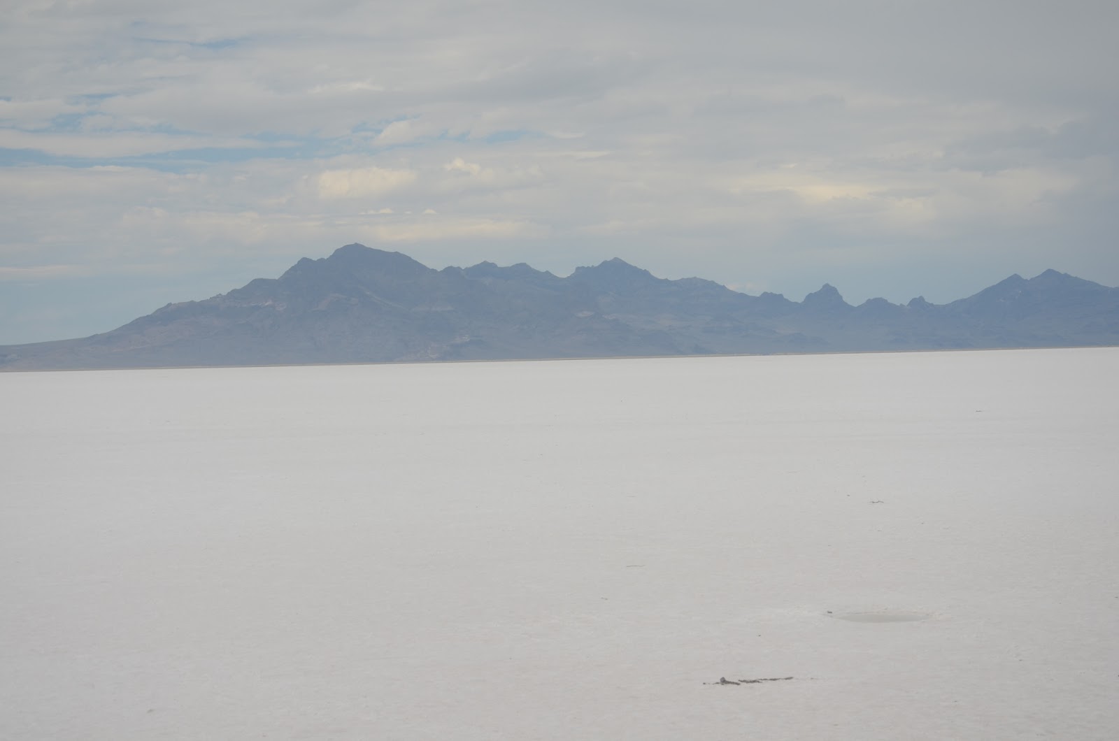
Salem sits right on I-5 so Saturday was going to be an Interstate day where we simply mounted our trusty steeds, made it to the highway, then pointed our motorcycles north. No subtlety, just ride for the day with no expectation of seeing anything spectacular enough to merit a stop. 

Riding from Salem to Portland, OR, was the usual semi-urban and urban experience; lots of traffic but at least it was moving smoothly until we arrived in Portland where it slowed from the 70 mph speed limit to the mid fifties but it was really no big problem. However, with the traffic there was no time for rubbernecking because focus is all-important when riding a motorcycle surrounded by vehicles in which drivers can be distracted and unaware of something as small as a motorcycle.

On the I-5 through Portland, OR


Portland can also be a complicated city to pass through with its series of on and off ramps and signage that at times can be confusing. However, by carefully watching my GPS and keeping a close eye on the road signs we were able to make it through Portland with no problems, eventually arriving at the bridge over the Columbia River to Vancouver, WA. Like many of the bridges over the Columbia it is a long one with a lift span to accommodate the ocean going freighters that make it up the river to Vancouver. 

I-5 bridge over the Columbia River between Portland, OR, and Vancouver, WA

Traffic was still steady as we entered Vancouver and rode north to Longview-Kelso where we made our first Starbucks stop after a stint of than one hundred kilometres through steady traffic. While we were waiting in line a guy behind me struck up a conversation about buying a used Harley. He had been talking to a guy who was selling a Fatboy with about seven thousand miles on it. The price seemed reasonable and he asked me what I thought. Being somewhat biased in the matter, I suggested that he see, take it for a ride to see if it was for him and then if he liked it, make an offer. He was going to have to take out a loan so he had already made an offer that was below the asking price and another interested person had made the same offer. Garry joined the conversation, added some comments, and we wished him luck with whatever we decided to do.

Leaving Kelso, we stopped about forty miles up the highway at a rest stop then continued north to Olympia. Again, traffic was steady and riding took focus, but we cleared the city and passed the large Joint Base Lewis-McChord (JBLM) which some time ago combined the US McChord Air Force Base and the Fort Lewis Army Base south of Tacoma, WA.

In Tacoma traffic ground to a very slow pace as lines merged and we were subjected to a lot of stop and very slow go movement. On a relatively warm day and dressed in leathers, this wasn't the most pleasant experience but it would have been much worse if we were in the heat that we had been experiencing for the past two weeks.

North of Tacoma the pace increased until we arrived in Seattle where we were again immersed in the snail's pace movement that now seems to be the norm in this city. Ordinarily traffic picks up speed when it clears the bottleneck under the Seattle Convention Center, but not today. We managed at best perhaps forty miles per hour on a sixty-five mph highway, and this was Saturday afternoon.

However, the worst was yet to come. For some reason, traffic always seems to be slow in Everett, WA, and today fit the norm. Here we experienced real stop and go from south of the city almost to Marysville when we resumed normal Interstate speed for the short haul to Sound H-D where we stopped for a respite from traffic and the heat in the air conditioned dealership after more than three hours in the saddle and almost constant slow and heavy traffic.

At the dealership I spoke to Mike, their service writer. and explained to him that although they have been servicing my Harley for five years, the dollar was now so week that I could't afford to return. Their service rate of one hundred and five dollars an hour is comparable with Canadian rates, but when a thirty-five percent premium is added, it costs me more than one hundred and forty dollars and hour just for labour, and parts are additional. I could see the light go on when Mike said, 'That might explain why some of my Canadian regulars haven't been back lately.'

The final twenty-five miles (forty kilometres) to Burlington were uneventful and we pulled into the Sterling Motor Hotel to get a room for the night. The Sterling is a bit of a fleabag motel but it is clean, central, and relatively cheap, which makes it a perfect choice for an overnight stay. However, what we hadn't counted on was the hydroplane races nearby and when we went to check in we got the last two bed room that was available. When we opened the door there was a strong smell of bleach which only made us wonder what had happened in the room before we arrived, but it was good enough.

Once again however, we saw first hand evidence of the extreme poverty that exists in many parts of the US. This motel has a resident population, people who actually rent by the month and make this place their home. It does seem to be a small community and residents seem to know each other and get along. As I have mentioned before though, these places are just one step above living out of a car or being homeless and it is somewhat sad to see the small things that people have done to make their room into a home. 

After we settled in we made a visit to the Five Guys burger restaurant and had our dinner. One thing is for certain. In many of these places there seems to an excess of food, and for the umpteenth time, Garry and I were unable to eat all that came with our order so it went into the garbage Judging from the portion sizes in many fast food places, the obesity epidemic in the US isn't too difficult to explain.

Today was our last full day on the road and it wasn't one of the best with heavy traffic and relatively mundane scenery. Sunday will see us arrive home after a really great ride and we are both anticipating being home, sleeping in our own beds, and not having to pack up every morning.

Tuesday 25 August 2015

Serendipity

After Thursday's long ride we had planned a shorter leg on Friday. We weren't quite certain which way to ride to I-5 and Salem, OR, but we knew that we weren't going to be travelling on Highway 26 for two reasons. First, we had ridden it on our last trip to Sturgis, and second, it was closed because of a wildfire.  We had been hearing about highway closures on account of fire, but to this point we had been 'threading the needle' so to speak, with our route avoiding any delays or road closures.

Before we began our day's ride we stopped at Starbucks then did errands that we hadn't been able to do yesterday. First, we returned to Wildhorse Harley Davidson because Garry wanted to buy one of their mugs. It is really quite an attractive mug showing a wild horse rendered in black, blue, and white, in full flight. Our next stop was at Deschutes Brewery, one of Bend's most well known businesses. If I'd had the time and didn't have to drive I could have spent a few hours there sampling their wares, but alas, it was not to be. Mainly because it was before ten o'clock in the morning.

Did Steve Austin open a business after retiring from wrestling?

A short note about GPS. GPS is one of the great inventions of modern man, ranking up there along with Coleman gas stoves and lanterns. However, I have found that as awesome as GPS is, having one can make you dependent on them to the point that you believe your GPS rather than your eyes. That has happened to me a couple of times on this trip. Yesterday I was so focused of following directions that I didn't notice the Starbucks right in front of me, so I rode to the one that the GPS told me was nearby. Garry, on the other hand, not being tethered to the machine, saw the Starbucks right in front of and went to it assuming that I had seen it as well. That's something to be aware of on future trips although in the vast majority of cases it is the best thing to happen to riding in strange places since the inflatable tire.

That being said, the GPS pointed us in the right direction to the little town of Sisters about twenty miles west of Bend, We turned from the secondary highway to the tertiary one which took us through a long avenue of pine trees as we made our way west.

Horse sculpture in Sisters, OR

Last night when we were looking at the map of Oregon I noticed a road with the notation 'Closed in the Winter'. "That sounds like a good road to take," I remarked to Garry and we agreed. This was the road and it didn't disappoint.

Serendipity is loosely defined as finding something of value when you aren't really looking for it. Finding this road was serendipity. Neither of us had ever heard of the Old McKenzie Highway (Highway 242) but it was to prove one of the highlights of our ride.

As the road began to climb from the pine forest it became a series of twists and turns, just the kind of road that a motorcyclist loves. As we climbed the temperature dropped from the low seventies (F.) into the low fifties or high forties. People who had been dressed in shorts and T-shirts soon received a surprise when they stepped out of their cars into the brisk wind. Most ran back to their vehicles and pulled on something warm to cut the wind.
Lava field on the Old McKenzie Highway

The first viewpoint showed us a large lava field that was two or three miles across. Nothing grew on the lava, so I assumed that it must have been a recent flow. I took a few photos then continued on as the highway snaked through piles of lava on its climb to the summit which was 5325 feet in elevation. Here the wind was quite chilly and for the first time in almost three weeks I was really glad to be wearing leather chaps and a leather jacket.


At the summit of the McKenzie Highway is an observatory named for the man, Dee Wright, who was in charge of building it. The highway was completed in the 1920s and Wright died in 1934. He had worked for the Forest Service for twenty-four years so the observatory was named for him the following year and still carries his name eighty years later.
Dee Wright Observatory at McKenzie Summit

On the western side of the pass the highway passed through different parts of the lava field which had come from three different craters and which had been formed about 1500 years ago. I found it surprising that in the ensuing millennium and a half not many plants seem to have been unable to establish themselves in the lava field but perhaps the altitude had something to do with that because outside the lava field trees and plants grow in profusion.


Lava field from the Dee Wright Observatory at McKenzie Summit


Because the highway loses altitude reasonably quickly it became a series of switchbacks and curves which had us losing two thousand feet in elevation in a short time. We stopped at one of the falls that are present in this area but it was a walk of more than a mile in our motorcycle boots so we decided not to see it. However, we did meet two young ladies who had a most unusual pet; Emmett, the miniature Vietnamese potbellied pig. We noticed Emmett because he was taking exception to being placed in his stroller and was expressing his displeasure with a series of loud squeals. We chatted with the women for a few minutes before they hiked up the trail to the falls. Emmett was looking forward to some free time and didn't like having to ride in a stroller.

Tyical section of the Old McKenzie Highway in Oregon

Emmett, the miniature Vietnamese potbellied pig

We continued on to the intersection of Highway 126 stopping before the junction, at Sahali Falls which cascades some ten metres over a lava dam. Stopping was another serendipitous event, because the falls turned out to be an incredibly beautiful sight and there were very few people there to enjoy it.
Sahali Falls


Sahali Falls

We made the turn onto Highway 126 which again was a terrific ride with many curves, elevation change and some good vistas. However, we were getting into the later afternoon and needed to make some time s we made no more stops until we came to the town with the best name for a town that we saw all trip, although initially I thought they may have put it in the wrong state after listening to Lynyrd Skynard nine days previously.

Sweet Home, OR, is one of those little towns that time seems to have passed by. It was probably a thriving logging town in the 1950s and '60s, then sort of petered out and just maintains itself now with tourism and some forestry. We stopped at Subway for a sandwich and when I mentioned that this town had one o hte best names ever, he said that when people asked him where he was from and he said Sweet Home, people would say, "Funny, you don't sound like you're from Alabama."


Sweet Home, OR

Sweet Home has an A&W that has the original design with a covered drive in area and a main building with a rectangular peaked roof. Those who went to A&W in the 1950s and '60s would recognize the design. In addition, there were even car hops. People drive into a spot and turn on their lights when they are ready to order. I don't know if they had window trays, but it was close enough for me to experience a bit of nostalgia.

A&W in Sweet Home, OR

The remainder of the ride was quite straightforward. We hit I-5, rode to Salem, OR, took the exit to Salem H-D and went in to check out the dealership. And lo & behold! Our motel 6 was about fifty yards up the street, so we were able to park, check in, & get settled for the evening in short order. This was one of the few times when it was really easy because Garry had reserved the room at hotels.com the night before and as well as having the certainty of a place to stay, we were assured of a reasonable price for the room.

Today was a day of contrasts. Yesterday we were riding in the eastern Oregon desert, today in a coastal rainforest. Yesterday we experienced temperatures of more than 100 degrees F. today the temperature was in the high forties. Yesterday the roads were straight and we could see for miles. Today, there were curves and switchbacks and we could see only to the edge of the highway. Yesterday we rode for many miles before seeing signs of human habitation. Today, people are everywhere. This is probably the largest change from day to day that we have seen on our whole trip.

Saturday will be a work day, a ride straight up I-5 through Portland, Vancouver, WA, Olympia, Tacoma, Seattle, Everett, then to the final stop on our trip, Burlington, WA.


Wednesday 19 August 2015

The Desolation of...Not Smaug

For almost two weeks now we have been riding in semi desert. The temperatures have been in the high nineties and low hundred degrees F. during the time that we are riding and when you're riding on the Interstate at seventy-five or eighty miles per hour, it's just kind of dumb to ride without protection and a flat tire is only a puncture away. Black leathers and high temperatures are hard on a person. Even if you stay hydrated as we do, sometimes the heat just gets to you. And if you are doing a long ride in hot weather it can be debilitating by the end of the day.
 
The journey from Winnemucca, NV, to Bend, OR, was one of those rides. When we rolled out of Winnemucca the thermometer on the local bank read 83 F. By the time we arrived at McDermitt, NV, right on the Oregon border, the temperature was already in the nineties. The highway, US 95, took us along a range of mountains, so while the highway was straight, the mountains on our right were substantial.


Mountains along US 95, north of Winnemucca, NV
 

About thirty miles north of Winnemucca, we came upon a highway advisory that told us to take an alternate route because Highway 95 was closed at Jordan Valley, OR. We found out later that there was a large wildfire there. I pulled out my trusty HOG Touring Handbook and we found that the highway was closed well past where we planned to turn west anyway, so we continued on our original route.
 
Nevada is essentially desert and in most places the tallest vegetation is sagebrush and dried grasses with patches of dirt, I hesitate to call it soil, in between. The land is wide open and you can see for miles in any direction. And it is dry. If you kick it up it just raises dust. I can imagine in the old days before roads here, that if a person didn't really know what he was getting himself into, it would be quite easy to die here. This country, although it is beautiful, is most unforgiving, I suspect.
 
It is always our habit to fuel up whenever we have the chance when we are riding through territory like this. It is sparsely populated and you never know when you can fill up again. Places on the map often do not have services and running dry in the desert can be disastrous. We stopped at McDermitt to refuel before moving into Oregon.
 
Most of the secondary roads that we have ridden in Montana, Wyoming, Utah, and Nevada have a seventy mile per hour speed limit. That seems reasonable when you consider that these roads are often quite straight, and that there is very little traffic on them. However, when we crossed into Oregon the signs said, 'Speed 55'. We initially kept to that limit, but we soon found ourselves, out of habit, cruising along at seventy mph. And we were occasionally being passed. It was obvious that the posted speed was a suggestion, not a limit.
 
Through the eastern Oregon desert.
 
Fifty-five miles north of MecDermitt we turned from US 95 to State Highway 78 which would take us ninety-one miles to Burns, OR. In our travels through Montana, Wyoming, South Dakota, Utah, and Nevada, we have seen desolate country, but nothing like that of southeastern Oregon.  In those aforementioned states there are frequently side roads that lead to small communities or whatever they lead to. In this part of Oregon we could ride for twenty-five miles (forty kilometres) without seeing a cross road. That is simply because there was nowhere to go. The cross roads that we did see had signs like Fields 18, later on we saw another sign, Fields 62. Both were dirt roads. Whoever lived at the end of sixty-two miles of dirt road must live pretty isolated existence. The only animals we saw were road kill rabbits. A crow would have to pack a lunch to cross this country.
 

Semi desert in eastern Oregon

 
We finally reached Burns, OR, a place I had never heard of before and stopped in a bar for lunch. The place was pretty bike friendly and the menu even had a picture of a motorcycle identical to mine. I remarked on this to the waitress, and she said that the owner was really into riding and that the photo on the front of the menu was of here motorcycle.
 
We filled our almost empty tanks then carried on west on Highway 20. Again, this land was desolate with very few crossroads. The temperature was well over one hundred degrees F. so we stopped at a little places called Hampton Station for a break. The people were friendly and offered us ice water. We bought ice cream cones to cool off them took them up on the offer of water. The original settlers arrived here in 1910, and to see their accounts of what happened when they tried to plant crops was heartbreaking. Several accounts had entries like. 'Planted 6 acres of barley. Drought, harvested three tons of straw'. Or, 'Planted 3 acres of wheat. Drought. Remainder of crop destroyed by rabbits'. It must have been incredibly difficult to wrest a living from this place.
 
The last sixty miles to bend were through some farmland. It seems that there is irrigation here but the main crop is hay. There are large shelters dedicated to protecting the large bales of hay here and large trucks transport the hay from the fields to these shelters.

In one of the irrigated fields I noticed what I thought was a herd of deer taking advantage of the succulent green grass. However, after a second look, not easy to do at seventy miles per hour, I saw that they herd was actually one of antelope - seven of them. I hadn't seen antelope on the whole trip so to see seven of them grazing in a field close to the highway was a special sight.

On the way into Bend we passed a deep canyon which had been created when a large lake that had been contained by a volcanic berm had broken through the loosely formed rocks and scoured a canyon there.
 
In Bend, we headed to the Harley dealer, Wild Horse H-D, in order to get out of the heat and into a place that was air conditioned. We checked out the bikes and merchandise but didn't buy anything. As we were leaving we struck up a conversation with a guy who had just ridden his 1992 Heritage Softtail into the parking lot. It turns out that he had worked for BC Hydro near Merritt, BC, almost forty years ago and then had moved to Bend to work for the power company there, so he was a bit familiar with British Columbia when we told him where we were from. His lady friend owns a dairy farm out on the Oregon coast near Tillamook, OR, and she has almost nine hundred cattle. All of the milk goes to make the famous Tillamook Cheese. I suspect that this is one very well off woman.

I was speaking to a local guy at the dealership and mentioned that I thought the 55 mph speed limit on a deserted highway with no crossroads and very little traffic seemed kind of ridiculously low. He said that in other states the signs say 'Speed Limit' but in Oregon, they only say speed. He says that Oregon laws are written in such a way that you can drive a reasonable speed on these roads and unless you're doing something really stupid like dangerous passing or excessive speeding, the state troopers are pretty good about being reasonably over the limit. However, if you are stopped and give the trooper attitude, or if s/he is having a bad day, they can still write you a ticket. Interesting, to say the least. A bit like traffic ticket Russian roulette.
 
We did the last twelve miles to Redmond, OR, to our motel. We didn't get a room in Bend because it was almost fifty dollars more so the extra twelve miles was worth the ride. I was so done by the time that we arrived at our hotel, that after a short ride to find a Starbucks, during which Garry and I became separated, that when Garry suggested that we go out to get dinner, I demurred and stayed in the room. Garry brought me back a Big Mac from MacDonald's so I did get dinner , but the more than six hundred kilometres that we had ridden in hundred degree F. temperatures had taken its toll.
 
At the end of the day we were positioned for three days of relatively short rides to make it back to Canada, and out home, sweet home, in Campbell River. It was an exacting day, but a good one.

Saturday 15 August 2015

I've Been Everywhere Man...

The title refers to a song that an old time singer named Hank Snow used to sing. In it he sings a list of places he has been and among them is a place called Winnemucca. Three years ago Garry and I rode through Winnemucca on our way to Reno, NV. This time we planned on staying.
 
Today was a day of desert riding on I-80. The desert is quite empty except for the occasional small town or rest stop. This part of America is in many ways much like it was a hundred and fifty years ago. The one thing that seems to be constant is the railroad which runs close to the Interstate for miles and miles.
 
View from I-80 between Battle Mountain and Winnemucca, NV


Still, this land has a strange attraction despite its brown landscape suffocating summer heat and frigid winter temperatures. It is hard to imagine how hard the first people, either indigenous or white, had to work to survive. There is very little to support human life here.
 
 From Wendover, UT, to Winnemucca, NV
 
As we passed through Wells, NV, we passed a fireman setting up an Emergency sign on the highway. Slightly further along on an off ramp we saw the reason why. A Budget van had rear ended a semi and it looked like the top of the cab had been sheared off and even the part that overhangs the cab was crushed. Garry said he saw another vehicle behind the van and it may have been rear ended into the semi. Whatever happened it looked very serious.
 
The temperature again must have topped one hundred degrees F. Riding day after day in those temperatures saps your energy and it is extremely important to stay hydrated. When we arrived in Winnemucca we were ready to call it a day.
 
It was one of those days where the main point was to get to where we need to be for the next day. On Friday the plan was to ride to Bend, OR, a distance of more than 600 kilometres. This ride is one on the most difficult stages of out trip, but it gets us closer to home.

Friday 14 August 2015

Running Hot

After reaching Rock Springs we were on I-80, one of the main highways crossing the US from east to west. Leaving Rock Springs before 8:30 a.m. we headed west toward Salt Lake City. West of Green River, WY, the land opens up and in the distance a colourful low ridge lies to the north. The colours of the landscape are muted browns and greys with some layered reds in the rock formations. The overall impression though is that of a very dry place where most plants have used up the moisture of spring, grown quickly, then died and turned brown. In most places the only green is that of the sagebrush.

Landscape west of Green River, WY


Distant rock formations west of Green River, WY
 
As we rode closer to the Utah border the highway began to climb through more colourful rock formations until it reached a summit and a rest area. Far below, the Union Pacific Railroad ran along a small  river. It is sobering to think that this was part of the original Union Pacific rail line that met the Central Pacific Railroad line at promontory Point, Utah, in 1869. This line has been in continuous use for almost one hundred and fifty years and in the 1940s and '50s the famed Union Pacific 'Big Boy' locomotives used to pound their way to and from Cheyenne, WY. It must have been something to stand on this spot in the winter and watch the smoke and steam from legendary locomotives as they pounded their way up the grade from Logan, UT.

 
Union Pacific line in the gorge

Rock formations near the WY, UT border


Rock formations with sagebrush in the foreground

I-80 and Union Pacific line to the west

Trusty steeds parked at the rest stop
 
Many trucks use this rest stop and while we were there a car carrier pulled in with a load of cars from Massachusetts. Most were run of the mill ordinary cars but one stood out. It was a 1970s Plymouth Fury with Los Angeles police markings. It seemed somewhat strange to see a classic Los Angeles police car with Massachusetts plates on it  being brought back to the west.
 
1970s Los Angeles police car


We stopped to refuel in Echo, UT, and continued on toward Salt Lake City. As we came closer to the city I-80 began to descend through a series of curves until around the last curve we were rewarded with the sight of the Great Valley of the Salt Lake and Salt Lake City itself laid out before us.
 

Riding in to Salt Lake City
 
At this point the temperature was close to one hundred degrees Fahrenheit and our immediate goal was to visit Salt Lake Harley-Davidson. When we arrived a met two guys who had been waiting there for close to three hours. One of the guys had to have his rear tire replaced. When I asked him where he was from, he told me, 'Vancouver Island'. When I asked where on the Island, he replied, 'Nanaimo'. It was like a reunion when I told him I was from Campbell River.
 
After failing to find two Starbucks because my GPS sent me to places where they weren't, we again rejoined I-80 and continued on west. On our right we could see the Great Salt Lake. It appears to be closer to the highway than it was three years ago, but the large pavilion where people used to go when they went swimming in the lake, appears to be abandoned.
 
We followed the lake until it ended and the I-80 ran straight across the Great Salt lake Desert for more than 80 miles. Along the way I saw a large plant where salt id mined to make Morton's salt, a brand that is well Known in the US. I suspect that the salt is used industrially and for salting roads in the winter. There was a rail siding with a number of railway cars which were either loaded or waiting to be loaded.
 
As we moved west the skies became very dark and we could see lightning bolts to our south as well as rain to our front. We stopped under an overpass and prepared to ride in the rain. Within minutes of getting back on the highway we were hit by rain. Fortunately, it lasted for only a few minutes, and then the sun returned, although when I stopped at a rest area I could see the storm moving east.
 
Garry had ridden on a head but since we both knew where we were going to stay, it wasn't a problem, so I took the time to stop and look at the sights along the way. Near the western end of the Great Salt Desert is the famed Bonneville Speedway, where world land speed records are attempted and set. I stopped just to say that I had walked on the same salt as that on the Bonneville Speedway. Strange as it seems, the salt is quite moist and as you walk on it, it cakes on the bottom of your boots and has to be washed off. The stuff isn't dry and if you dig down a few inches (centimeters) you will find water, albeit, very salty water.
 
Plaque explaining the significance of the Bonneville Salt Flats

View across the Bonneville Salt Flats


Me, standing on the Bonneville Salt Flats


Salt crystals

Subsurface water at the Bonneville Salt Flats

 
It was only another seven miles to Wendover, UT where we stopped for the night. This is a strange town. It straddles the Utah-Nevada border. The Utah side looks run down while the Nevada side has casinos and looks much more prosperous. At the Montego Bay Casino the casino is in Nevada and the parking lot in Utah. Across the street, The Nugget is also on the border. In fact, there is a line across the street marked Utah on one side, and Nevada on the other. Both of the large casinos are built within a foot of the border.  The Mountain and Pacific Time Zones are on either side of the border, so we were able not only to walk from one state to the other, but we also were able to gain and lose an hour simply by taking a few steps. It was a bit of a novelty for us to do this.
 
Casino on the Utah-Nevada border

The state line

Just inside Nevada
 
Because of the distances involved in doing anything in these western states, some educational institutions are making the effort to reach out to people. Utah State University is even using Wendover High School as a satellite campus. It seems like a great idea to use existing facilities to deliver university programs to people who would otherwise not have the opportunity to get these courses.
 

University in a high school
 

The plan for Wednesday was to ride to Winnemucca, setting the stage for another long ride to Bend, OR. We had a double whammy of extreme heat and rain with high winds pushing our bikes around. The heat we have been experiencing saps energy but we have been able to manage it to this point. And the trip continues to be terrific. This is one that we'll remember for a long time.


Wednesday 12 August 2015

Still Heading South

In every direction from Cody, WY, there is something spectacular. To the north is the Chief Joseph Scenic Byway, to the east, the Bighorn Pass which rises to more than 9000 feet, to the west is the East Portal of Yellowstone Park. We have ridden all three of these so the only direction left to go was south over South Pass on our way to Rock Springs, WY. And it was here that we rode through across the high plains through towns with names like Meeteetse, Thermopolis, Shoshoni, Riverton, and Lander before beginning our climb to the summit of South Pass at 7550 feet.
 

Open prairie south of Cody, WY

 
At a rest stop north of Thermopolis we met two couples from Fort MacMurray, AB. They were on their way home from Sturgis and had just ridden a mountain pass between Buffalo, WY, to Ten Sleeps, WY. They said it was a great ride and highly recommended. it. Perhaps sometime in the future. The rest area was set in some unique rock formations, so of course, I took some photos.


South of Thermopolis the highway entered the Wind River Canyon. At the north end of the canyon were the younger rocks of the Chugwater Formation that were formed more than 250 million years ago, and at the southern end the Precambrian granites were exposed. These rocks are more than 600 million years old. If you are paying attention you can see more than 350 million years of the Earth's history in the rocks that are exposed form one end of this canyon to the other. I find that an overwhelming thought and it brings in to stark relief the insignificance of our time on this planet. This canyon is probably the most beautiful I have seen with its swift flowing clear river. Opposite the highway, railway tracks cling to the edge of the river and climb from the south to Thermopolis.
Wind River Canyon, WY


Plaque explaining the geology of the Wind River Canyon

 
At the south end of the canyon the land opens up and a dam stores the water of the Wind River for power generation and irrigation in a large lake, the Boysen Reservoir, which is visible from the highway.
 
Boysen Reservoir with power dam


Boysen Reservoir

 
Many of the three hundred and fifty to four hundred thousand settlers who moved west from the early 1840s until the mid 1860s traversed these passes either to Oregon and California, or the Mormons who made their way to Utah.
 
Sometimes you get a glance of a scene that is beautiful and sticks in your mind for a long time. As we rode I glanced to my right over a small clear river below the highway. I was fortunate enough to see two antelope daintily picking their way across the rocky stream. This sight lasted no longer than five or six seconds but I found it incredibly beautiful.

Garry had taken the lead earlier so I was following about half a kilometre back when I saw what looked to be leaves blowing across the highway. Since there was no vegetation that produced leaves in the area I was somewhat curious. As I came closer and could see more clearly I saw that the 'leaves' was in fact a flock of about fifteen chukar, a small ground bird slightly larger than a quail, running across the highway. There was a larger bird, presumably the mother, with close to fifteen smaller birds scrambling across the highway. When I see things like this I am reminded of how fortunate I am to be able to travel to places that are totally unfamiliar to me, and to see sights that I would never see even close to my home in Campbell River.
 
Along the way we came across the striking red rock formations that we have seen for the past two days. From the viewpoint we could see the old wagon road that ran along the face of the cliff. This area is an animal refuge and during the winter it is possible to see more than seven hundred elk wintering in the area.
 
Red rock cliff


Old wagon road along the face of the red cliff

Winter elk range

Plaque explaining how the area is used

 
The final run into Rock Springs went quickly on a straight and level highway through wide open prairie. Rock Springs is on the Union Pacific Railroad line from Logan, UT, to Cheyenne, WY. In the 1940s and 1950s the largest locomotives ever built, the Union Pacific Big Boys were run through Rocks Springs. It must have been awe inspiring to see and hear these monsters as they charged up the long grades trailing more than one hundred freight cars in their wakes.
 
Today was a riding day with few stops except to view exceptional scenery and we really didn't meet anyone on the ride. tomorrow we will ride west on I-80 through Salt Lake City, across the Great Salt Desert, past the Bonneville Salt Flats to the Utah border.