After a decent night's sleep and a leisurely start to the day I left Hope, BC at about 9:00 a.m. I will forego the temptation to make a comment that I am now well and truly beyond Hope. Surprisingly, at least to me considering it is the beginning of the summer travel season, Highway 3 was relatively empty. There are sites of historical interest including the Hope Slide which happened on this highway in the mid 1960s. A somewhat obscure site is the Engineers' Road which was to provide a wagon road to the interior of BC. It was never completed but remnants are still visible. I can't imagine the labour that was necessary to build this road.
Plaque Commemorating the road to the BC Interior
A section of the Engineers' Wagon Road
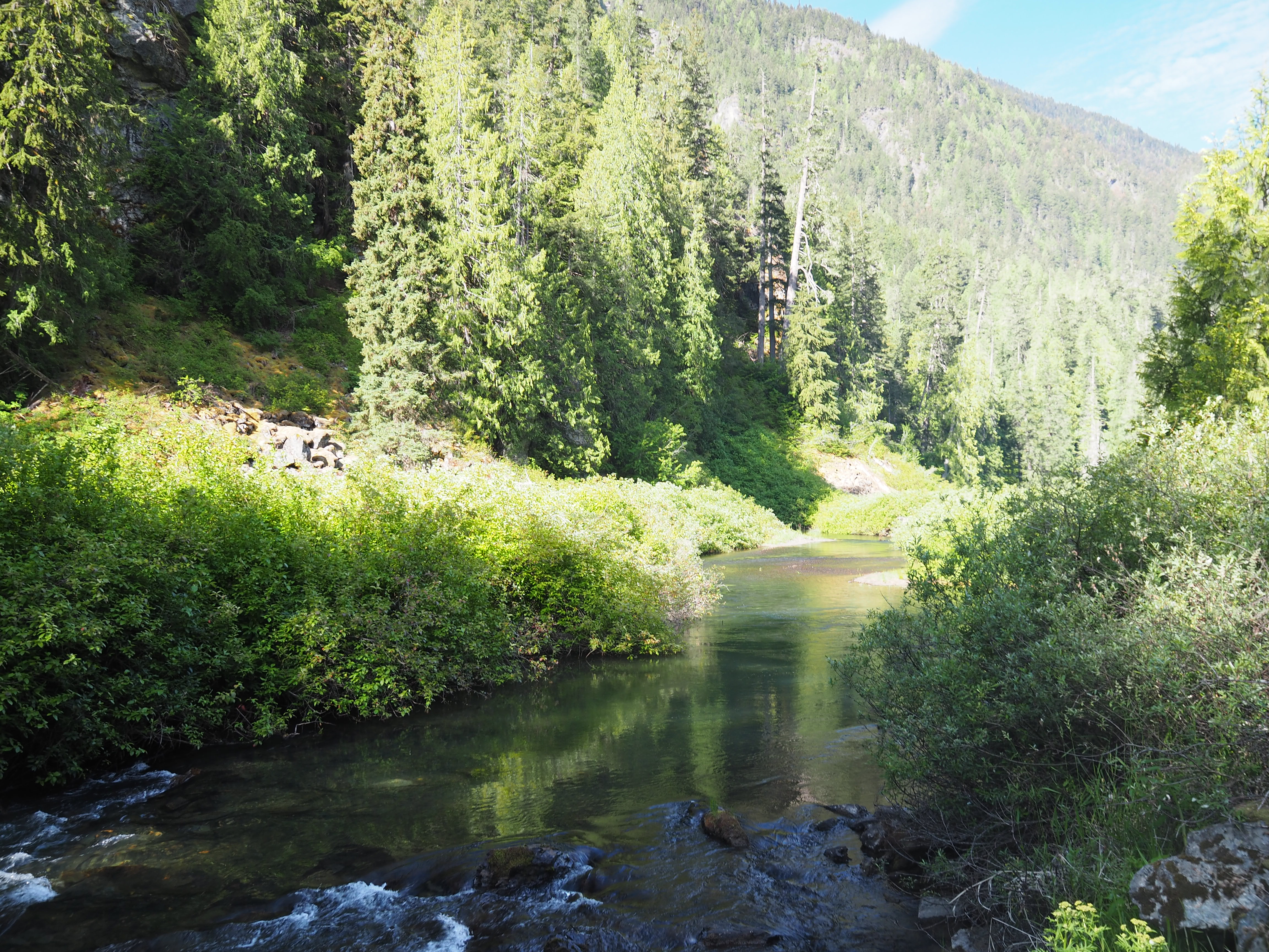
A small river runs along Highway 3 in this area. The water is clear and flows swiftly. If I had the time I would love to stop here and try fly fishing. I imagine that the trout here would be fun to catch.
River along Highway 3
There were some construction zones but traffic flowed smoothly into Manning Park. The Manning Park Lodge is worth a stop with fantastic wood carvings inside. Outside one can get relatively close to wildlife. One of the ravens was foraging under the trees and ground squirrels were playing hide and seek. I usually stop here to see these little guys.
Raven at Manning Park Lodge
Ground squirrels at Manning Park Lodge
The Heritage Classic resting at the Lodge
I stopped for fuel at Princeton and met two riders who had ridden from the Lower Mainland this morning. They were heading toward a small museum in Hedley, that is run by an older man who has collected items from to 1950s and '60s. They were planning to stop there, go to the small cafe, then turn around and ride back home. By my calculations, that is about 650 kilometres just to do a short visit to the museum and stop at the cafe. That is hardcore to my mind.
Carrying on east of Princeton, I stopped a Bromley Rock Provincial Park. The Similkameen River runs through the park and across the river there is a 15 metre cliff. In the summer when the current is slower, teenagers jump from to top in search of a thrill. I have seen the cliff jumpers on an earlier visit but today there were no jumpers, just families enjoying the cool water on a very hot day. I envied them as I stood by the river in my leathers.
The beautiful Similkameen River with Bromley Rock cliff.
Similkameen River
While I enjoyed the break, it was on the Hedley and Keremeos. Just west of the town at Ashnola, there is an enclosed red bridge. It was built by the VV&E (Vancouver, Victoria & Eastern) Railway in 1909. With the abandonment of the line in 1939 the three bridges were repurposed for road traffic. Two of the bridges washed out in spring floods and the tracks from Keremeos to Hedley were removed in 1955. The remaining bridge was enclosed somewhat late and is know as the 'Red Bridge'.
The 'Red Bridge' near Keremeos at Ashnola.
The beautiful Similkameen River
The shiny Similkameen River
When I ride this route in the summer, I usually stop at this fruit stand. Today there were apricots, some apples and two varieties of cherries. I bought about twenty, both Rainiers and Bings. I should have bought the Rainiers. They were fantastic. The cashier, a young East Asian man was particularly interested in my leather jacket. I was somewhat less so, because the temperature hovered at around 30C. However, one does what one must for the sake of safety.
Mariposa fruit stand in Keremeos.
Leaving Keremeos I followed the old railbed of the VV&E Railway for several kilomtres. The ride was a real pleasure and the Heritage ate up the kilomtres. One of the points of interest that I try to stop and view is Spotted Lake a sit that is considered to be sacred to the local Indigenous peoples. The have used it as a healing place for centuries. It is a most unusual feature.
Spotted Lake
Close up of Spotted Lake
Explanation of the importance of Spotted Lake.
Spotted Lake
I stopped for fuel in Osoyoos at the bottom of Anarchist Mountain. The highway climbs for 21 kilometres with many curves. A delightful ride to the top. Part way up the mountain there is a viewpoint that overlooks the Okanagan Valley, Okanagan Lake and Osoyoos. At the rest area I met a cyclist named Patrick who was hardcore. He appeared to be in his mid to late 60s and he had ridden up to the viewpoint. He is heavily into long distance cycle touring and does long distance riding. He does supported rides where his gear is transported to the next stop, often two hundred kilometres onward. He was getting ready to ride back to Osoyoos and say that he hits eight to ninety kph on the downhill. that is scary!
Okanagan Lake with Osoyoos in the centre.
Okanagan Lake and Washington State to the south
The loops of Highway 3 climbing Anarchist Mountain
Patrick with his touring cycle. He lives on the bay just off his right shoulder.
The area to the east of the mountain is ranch land and it at a higher altitude than the valley the land is dotted with isolated ranches and a small village named Bridesville, which used to be a stop on the VV&E Railway. I can't figure out why peoples till live here, but they do. One of the places that I have noticed on my rides here is an abandoned ranch house. Its isolation has a strange fascination for me so this time I stopped to take photos of it. I am intrigued by it. It is in a beautiful location.
Abandoned ranch house west of Rock Creek, BC
Close up of the abandoned ranch house.
I love this ride and the descent into Rock Creek. The descent offers views of the Kettle River, Rock Creek and the Kettle Valley. The scenery is the stuff of memories.
The highway to Grand Forks passes through Greenwood BC. During World War II, Japanese people were interned in the area and many stayed. The town was established in 1897 when the population was much higher. In the early 20th century a smelter was established there but with the collapse of copper prices at the end of World War I, the smelter closed. All that remains is the smoke stack which has become a symbol of the city.
I stopped in Grand Forks to pick up a drink but on the way east I saw a huge white cloud with a grey haze under it. I suspected that it was a fire near Christina Lake. I found out later that it was from a large forest fire near Colville, WA. When parked at the hotel that I an staying in, my bike had ash from the fire on it. Castlegar is under a pall of smoke and I could smell it for the last twenty-five kilometres of the ride into Castlegar.
Clouds from the forest fire near Colville, WA.
Several years ago I did two rides along the old Columbia & Western Railway roadbed. The roadbed runs under the Paulson Bridge. The bridge deck is 278 feet above the creeks bed. The bridge is one of my regular stops when I ride there.
The Paulson Bridge near Castlegar, BC
Today's ride was a much more pleasant experience than yesterday's traffic was light, the roads were good and the weather was ideal, at least to me. Today was the longest ride of the road trip covering more than 500 kilometres. Tomorrow will be as shorter day with about 230 kilometres to Cranbrook. And the weather should be great. I will have more time to stop and enjoy the scenery more than I have previously. This ride is looking to be a great one.


No comments:
Post a Comment