If yesterday was a tasty feast of curves & beautiful vistas, today was a veritable delicious banquet of more of the same. This part of the province is divided into north-south valleys separated by mountain ranges. Some highways run north/south in the river valleys and along the sides of mountains while others cross those mountains in a series of twists and turns and serious elevation change. In short, those roads are a motorcyclist's dream. And judging from the number of bikes we saw today a lot of riders have figured that out.
We left Nelson this morning, and on the way out of town I missed the turn to Highway 3 and ended up in a subdivision of the town. There was more up and down than straight ahead in this part of town and eventually the GPS bailed us out and got Jim and me back to the highway where we rode to Crescent City before turning north on Highway 6.
The Slocan Valley runs north from Crescent City through several communities including Slocan, New Denver, and Nakusp. A hundred years ago it was called the 'Silvery Slocan' because of the large number of silver mines in the area. Our first stop was at the village of Slocan where we continued to the lake where we saw more recent evidence of the hardship this alley has had to endure since then. At the end of the road we found a sawmill site that had been abandoned with the machinery long gone while the buildings deteriorated. It is a sad situation for a community that once was a booming, wealthy town. One wonders how the people there can still hang on and continue to make a living there.

View of the mountains near Slocan

Abandoned Canfor sawmill at Slocan
Our next stop was at Silverton where there is a mining museum with equipment used in mining more than a hundred years ago. It is another one of those small towns that had its heyday more than a hundred years ago but whose people have managed to find ways to make a living and continue to keep the time alive.

The history of mining in Silverton, BC
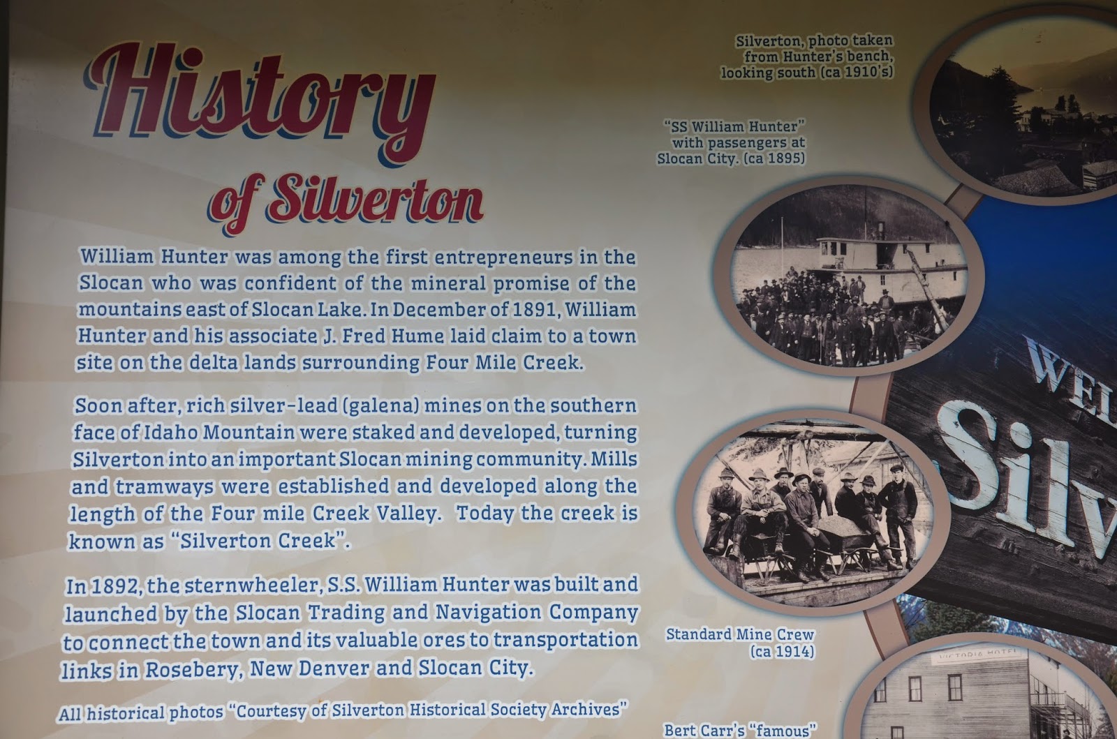
The history of Silverton, BC

Mining museum and old equipment at Silverton, BC
Riding on the east side of Slocan Lake north of Slocan, BC
Back on the road the highway about ten kilometres north of Slocan I saw a large black bear appear on the side of the highway, look at me, then do an about turn and scamper back into the trees. The highway climbed and clung to the side of the mountain high over Slocan Lake, providing incredible views and great riding. We stopped next at New Denver. It seems to be doing better than Slocan and the main street is lined with turn of the last century houses which seem to be well maintained. We stopped by what I believe is the original Valhalla Pure Outdoors store at the end of the main street. The view across the lake was once again, outstanding with snow capped mountains in the distance.

Sculpture in a park in New Denver, BC

View across the lake from New Denver, BC

View of the mountains north from New Denver, BC
Mountains near New Denver, BC

Mountains near New Denver, BC
Leaving New Denver, I missed a turn and we found ourselves heading toward Kaslo, not exactly where we wanted to be. It was the second time that I misread the GPS today after five days or error free riding. We did a U-turn, rode back to New Denver, and got back on Highway 6 until we arrived at Nakusp where we fuelled up, and had lunch. This little town seems to be doing better than the other two, mainly because of tourism, I suspect.

Summit Lake, BC

Summit Lake, BC
We headed south to the ferry at Fauquier, a place I had no idea even existed before today. The ferry is run on a cable, much like the one BC Ferries will be installing between Buckley Bay on Vancouver Island and Denman Island. The run across took about ten minutes and ended at Needles, on the other side.

Mountains across Lower Arrow Lake near Nakusp, BC

View across Lower Arrow Lake near Nakusp, BC

Cable ferry between Fauquier and Needles, BC

View of Lower Arrow Lake from the Needles ferry

View of Lower Arrow Lake from the Needles ferry
Again the highway served up a delicious mixture of curves and elevation change for more than a hundred kilometres to Lumby, BC. The land seemed to change when we arrived at the west side of Slocan Lake. The mountains were lower and covered with trees so although the highway was great the trees alongside the road cut off any views.
We came across some road work which was a first since we entered Canada but got through it without any trouble. Further on as we rounded a curve we came upon and ambulance parked across the highway. On out right a small blue vehicle was sitting upright in a depression about three metres below the level on the side of the road. The paramedics weren't at the car and nothing much was happening. There was a dent on the roof above the driver's seat. Later on we met an RCMP truck which presumable was on the way to the crash scene. Judging from the paramedics' inactivity and the lack of haste of the police officer, we surmise that the crash may have resulted in a fatality and the ambulance crew was awaiting the arrival of the police officer before carrying on.
We arrived in Vernon at about 4 o'clock, found a hotel room at a reasonable price and went to dinner at a Chinese restaurant before wrapping it up for the day. For the first time on this ride we had rain this afternoon. Strange, but last year the only place we had rain on our ride was in Vernon as well. I don't know what it is about Vernon, rain, and me. There must be a message in there somewhere.
Tomorrow we will ride the remaining hundred or so kilometres to Jim's place to wrap up the journey. This has been an outstanding ride. We have had more beautiful riding roads in the past week than many people see in years. We're even thinking that a possibility next year might be to spend some time in the Kootenays just enjoying the ride without having to be anywhere quickly. Time will tell.
No comments:
Post a Comment