After waiting through two days of rain in Kamloops and everywhere else in southern BC it seems, we awoke to some blue skies but with threatening grey clouds in the south. The forecast for today called for partly sunny skies with showers beginning around noon in the Okanagan Valley. The exception was for Vernon with showers called for around 9:00 a.m.
Jim & I rolled out of his driveway a few minutes after 7:00 a.m. and headed east on Highway 1 then south on Highway 97 to Vernon, where as was forecast, the rain began to fall. It was not an auspicious start to our ride to be rained upon less than an hour after leaving Kamloops. I spent an hour and a half washing and waxing my bike on Saturday, only to have it covered in road dirt less than thirty minutes after leaving home. Yesterday I spent a good half hour getting the road dirt off Big Red only to have the same thing happen. This weather is not impressing me.


Jim is ready to roll
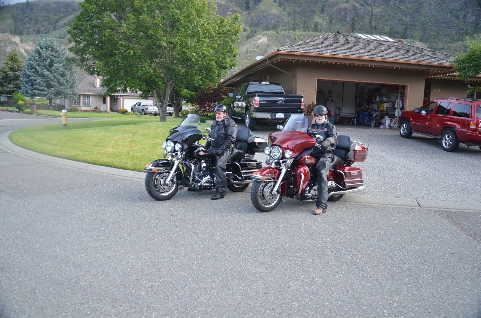
The journey begins. (See the shiny bikes.)
One of the things that I enjoy about riding is the smells. This morning we met trucks carrying spruce logs, bailed hay, fields of fresh cut hay, and cherry orchards, and the morning scent of fresh water lakes,each with its own very pleasant smell.
We rode through Vernon, stopping in Kelowna for gas, then on through Penticton and Osoyoos before crossing the border into the US at Oroville, WA. The crossing went well with the usual questions: Where are you going? How long will you be in the US? Do you have any tobacco or alcohol? Then, a new one. "Have you ever been fingerprinted?" I said, "Yes," and was asked why. I explained that I had been fingerprinted twice for employment purposes but not for any criminal reasons. When he asked Jim, the answer was, "No." "Right answer," replied the Customs Agent and he walked away letting Jim go. and the temperature was in the low 20s - perfect riding weather.
The skies looked threatening as we crossed the border but further south things lightened up and by the time we reached Bridgeport the sun was poking through. We stopped at the Chief Joseph Dam before reaching Bridgeport. This structure was built in 1950 but it is huge and is part of the system of dams along the Columbia River that are used for flood control and hydro generation. Unfortunately the dams destroyed the salmon runs that the local Indians (the American term) had relied upon for millennia.

The spillway at the Chief Joseph Dam

The powerhouse at the Chief Joseph Dam.
From Bridgeport to Moses Lake the volcanic origins of the land around here becomes apparent with bluffs composed of a brownish black rock, the result of volcanic eruptions in Central Washington between 17 million and 6 million years ago. Near Coulee City, the Dry Falls is a gorge created by the Missoula Floods more than ten thousand years ago when an ice dam broke releasing the waters of a huge lake through the Columbia River. The flood was so massive that it created gorges more than 400 feet deep.


Dry Falls

View from the cliff above Dry Falls

View of the cliffs at Dry Falls

View across the Dry Falls Gorge
The geography and geology of this land is large it is overwhelming. We rode through the gorge the Missoula Flood had created and were looking up at cliffs that stretched forty stories to the sky. If one takes a realistic view when travelling through landscapes like this it is easy to see how insignificant we really are.
The cliffs above Lake Lenore which is about 15 miles down the gorge have huge caves in the volcanic rock. Further on where one would expect to see fields growing wheat of hay, there are boulders as large as small cars strewn about for miles. Many of the boulders are smaller and some are long and thin and standing upright like gigantic menhirs without any pattern.
The land here is semi-desert but there are extensive wheat fields, plowed fields which stretch almost to the horizon, and several large lakes which add a touch of green to an essentially brown landscape.


The ever present sagebrush
We arrived at Moses Lake at about 5:00 p.m. and after searching found a room in the Sunland Motel for fifty dollars. It seems that people live here and at 10:00 p.m. the kids are running around crazily screaming & making lots of noise. The fifty bucks may not have been such a bargain after all. We did manage to get a bucket and some rags so we were able to get the road dirt of the bikes and they look shiny and clean again.


We are in downtown Moses Lake so we hiked to the local Irish pub, and a sad pub it was. One third of the menu wasn't available, there were no fries with the burgers, and the beer wasn't really cold, but the bleu fromage burger was filling and the price was pretty good. The waitress was tatted up with a piercing in each cheek. The tattoos were OK but the piercings were not what I would consider attractive.
After racking up 564 kilometres today we've been looking at the map and trying to decide where to go from here because it looks like the weather is improving everywhere. One possibility we've discussed is doing a run into Utah and checking out some of the national parks there but we'll have to decide whether the distance is manageable in the time we have. We'll have a better idea tomorrow.
It didn't take long for you to find some spectacular scenery, John. Take care.
ReplyDelete