After yesterday's windy and someone wet ride, it was a totally different beginning with an almost cloudless sky. It's always a great thing when one isn't concerned about rain. However, with Invermere being near the Rocky Mountains, the temperature was a bit lower than I expected at 13C. But at least it wasn't wet and I could look forward to it being warmer as the day went on.
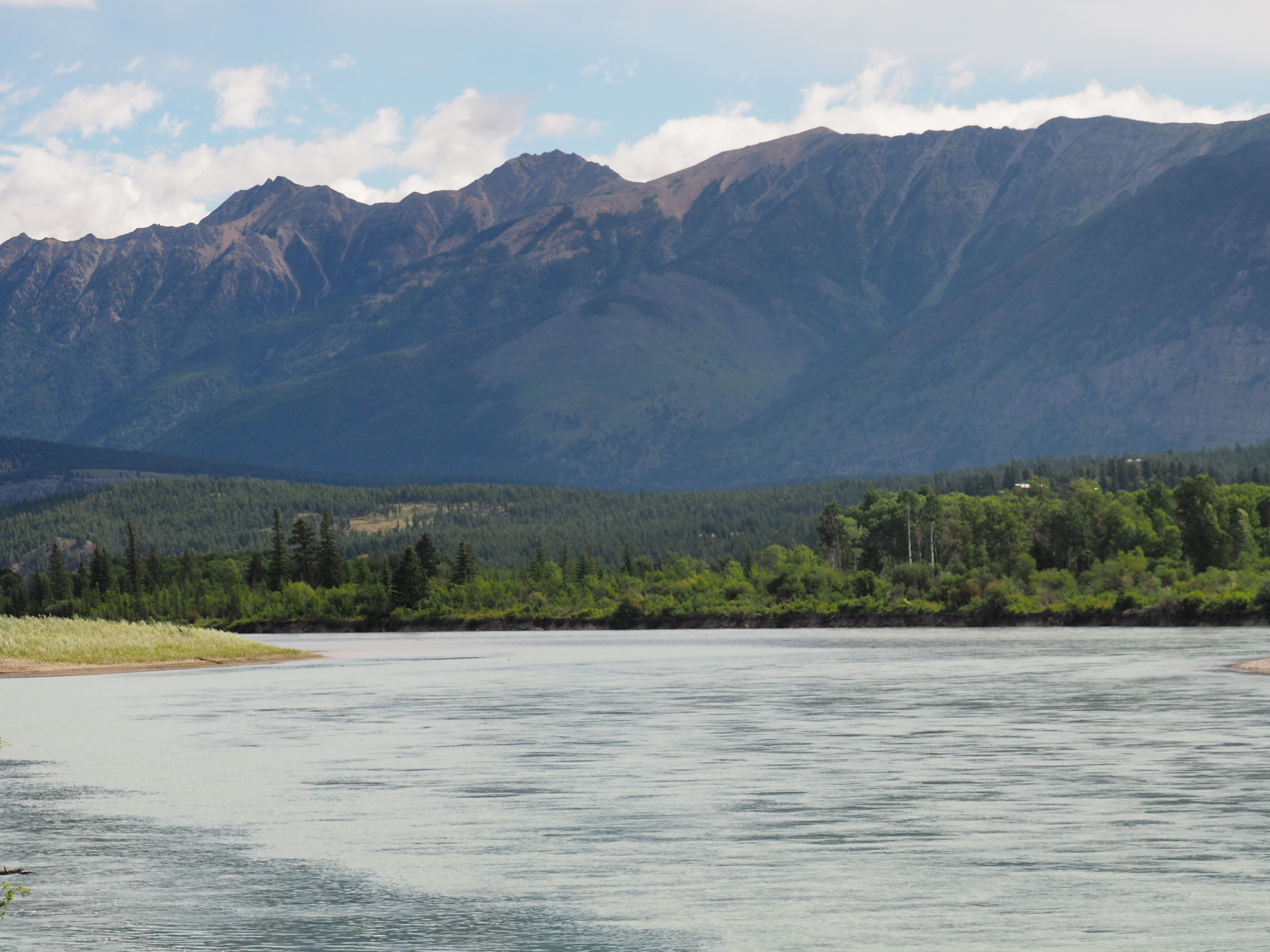
Traffic on the highway was light and I was able to roll along at an easy 100 kph. My first stop was at a viewing area overlooking the Columbia Valley. It is easy to see why people settled here in the 1800s. The land looks great for for farming and in the late 1800s the CPR built a line that ran from the coal mines of BC's southeast up to the main line at Golden. It is still used to haul coal, As luck would have it a coal train was running north below the viewpoint.

View across the Columbia Vally

Columbia Valley with coal train mid right
I raced ahead to get a viewpoint to see the passing train at a lumber yard in Brisco, BC. The train arrived as I waited so I took some photos of the locomotives close up. I love the sound of these machines. They rumble along and the ground vibrates as they pass.

CPKC line running north to Golden

CPKC locomotive in old livery

Tail end locomotive
Coal train gaining speed after a short stop.
I ran north to Golden where I stopped for fuel and a coffee break then merged onto the Trans Canada Highway heading the 150 kilometres to Revelstoke. This area is an incredibly important one in Canadian transportation history. Colonel Rogers found a route through the Rocky Mountains that was much father south than the route through the Pine Pass north of Prince George. From 1876 to 1885 surveyors explored the route, laid it out, and marked it for clearing. The Canadian Pacific Railway pushed the line through the mountains after crossing northern Ontario and the Prairies from the east while building the western portion through the Fraser Canyon along the Thompson River.
The route took the railway through some of the most incredibly beautiful country in the world. Those old time surveyors got it right because more than seventy-five years later the Trans Canada Highway was built in the same passes that the CPR first opened up.
The scenery is so spectacular that much of the area was designated as Glacier National Park. Here are some views of the mountains.

Glacier National Park
in Glacier National Park


When the TCH was completed in 1962, a memorial was placed at the summit of Rogers Pass. It is an iconic symbol of the completion of a modern road link that connected British Columbia to the rest of Canada.


Rogers Pass monument


The monument has a pom pom


View in Rogers Pass

105 mm howitzer formerly used for avalanche control in Rogers Pass
Leaving Rogers Pass I pushed on to Revelstoke where I stopped at the Revelstoke Railway Museum. Many of the towns along the Trans Canada Highway were established to service the CPR. These include Golden, Revelstoke, and Kamloops. So the CPR gave these towns their reason for existence. Revelstoke is particularly important as it was a main divisional point, and the Railway Museum reflects this. It's main display is one of the last steam locomotives built for the CPR.

CPR 5468


Mount Begbie near Revelstoke, BC.

Display locomotive at the Revelstoke Railway Museum

65 pound rail manufactured for the CPR in 1884
When I ride along this highway I always stop at Craigellachie to visit the spot where the last spike on the CPR was driven on November 7, 1885, symbolically connecting Canada to British Columbia and fulfilling one the conditions for BC's entry into Confederation in 1871. It is the spot where one of the iconic photographs in Canadian history, that of Donald Smith, Lord Strathcona driving the last spike to complete the railway. This spot is a place so deeply ingrained in Canadian history that I am always moved when I think of that moment almost 140 years ago.


Memorial erected on the 100th anniversary of the completion of the CPR.


65 pound rail manufactured for the CPR in 1883.

The Illecillawaet River at Craigellachie,BC

The final part of the day's ride was the 100 kilometre run in to Vernon. Most of the ride was behind a truck that seldom broke the 80 kph limit on on a highway that has a 90 kph speed limit. When I arrived in Vernon I had difficulty finding the hotel but eventually did, checking and ending my day. Today was the second longest distance of this trip at 451 kilometres. Tomorrow, on to Kamloops and a visit with my friends Jim and Sue in Kamloops. Looking forward to it.